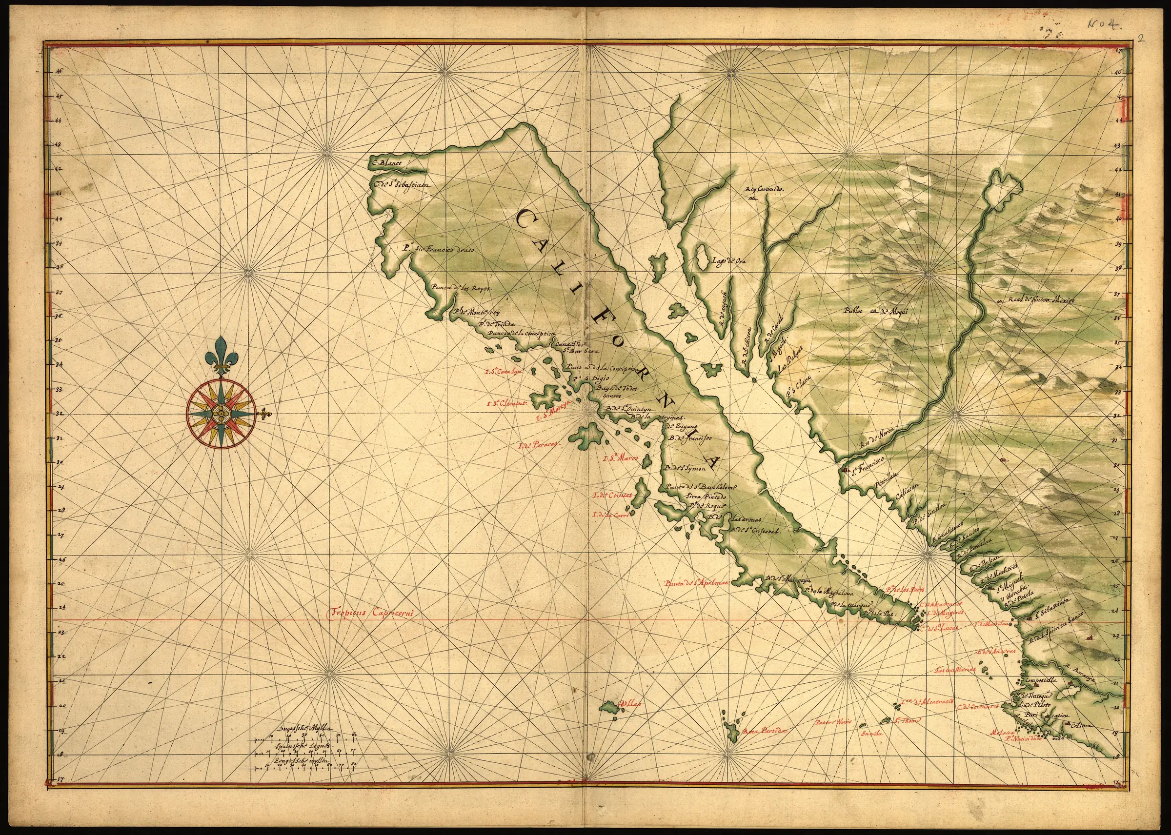
The island of California was not simply an old guess that survived unchanged from the first European maps. Earlier cartographers had sometimes shown the region attached to North America. The island form emerged as a new seventeenth-century error, built from incomplete exploration reports and manuscript geography.
From 1622 onward, the detached outline spread through European cartography. Major British and Dutch publishers reproduced it, and a circa-1650 map made for Dutch mercantile and military use shows California cleanly separated from the continent. Stanford’s surviving collection alone contains nearly 750 maps and related objects depicting California as an island.
The name is easy to misread today. The “California” on these maps was not simply the boundaries of the modern U.S. state. The supposed island usually included the Baja California peninsula and extended northward along the Pacific coast. In reality, Baja California is connected to the mainland at the head of the Gulf of California, and modern California lies on the North American mainland.
Eusebio Kino initially accepted the island model himself. Information from Indigenous communities and a series of expeditions near the Gila and Colorado rivers changed his view. Between 1698 and 1701 he gathered evidence for an overland route and concluded that the Gulf of California ended before cutting California off from the continent.
Kino sent a map of the land passage to Mexico City in 1701. A version reached Europe and was published in Paris in 1705. It supplied a geographically coherent alternative based on direct travel around the northern end of the gulf.
The correction was not instantaneous. Some mapmakers continued copying island forms for decades, and the Spanish crown formally declared in 1747 that California was not an island. Later overland journeys made the continental connection still harder to dispute.
This card uses 1622 as a representative start for the printed island-map tradition and 1705 as the representative correction point. Those dates do not imply universal agreement at either boundary: the strength of the example is precisely that a well-established cartographic model could persist after better geographic evidence was available.